Paynes Find Lithium
(E59/2660, E59/2661, E59/2662, E59/2679, ELA59/2680)
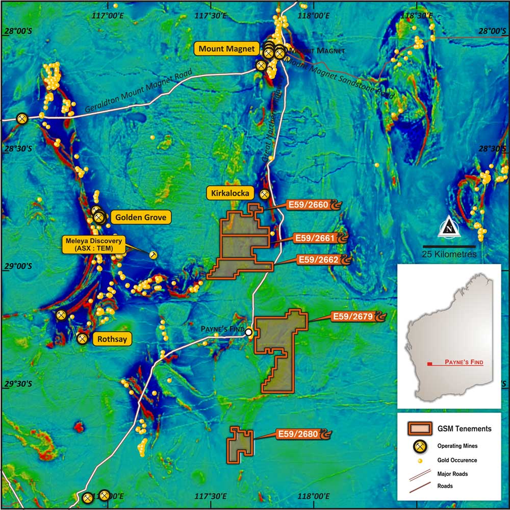
The Paynes Find project is located immediately east and 30kms north of the Paynes Find township in the Murchison region of Western Australia. The project is divided into three main tenement blocks called Paynes Find North (E59/2660-2662), Paynes Find Central (E59/2679) and Paynes Find South (E59/2680). GSM tenure includes five granted exploration licences and one exploration license application for a total of ~1302km2 .
Previous explorers have focussed mainly on greenstone belts adjacent to the project area with only minor, unsystematic exploration work completed on GSM’s tenure. This work was limited to geophysical interpretation and regional geochemistry sampling with a focus on gold, base metals and iron ore. However, literature searches of mines department records have revealed the potential for a range of commodities including lithium. This includes known lithium-bearing pegmatites (e.g. Mount Edon and Mullagee Well).
GSM’s extensive aeromagnetic and remote sensing research has revealed a geological setting of multiple granitic intrusive episodes, many of which appear to be “late-stage” intrusions, a favourable targeting factor for lithium mineralisation. Regolith interpretation and targeting initially delineated areas amenable for reconnaissance geochemistry. GSM has utilised the ultrafine soil technique for this purpose.
These soil geochemistry results have identified coherent lithium anomalism up to 217ppm, with strong pathfinder element support in several areas. Two priority targets up to 6km long are now the focus of soil infill testing with ground mapping and potential drill follow up.

